Harpers Ferry, West Virginia
In late August I had a day of leave to burn and with most of my "honey do's" done I thought I would sneak out to
Harpers Ferry for a few hours worth of hiking. A historic town in Jefferson County, West Virginia, it sits at the confluence of the Shenandoah and Potomac Rivers. It also happens to be the headquarters of the
Appalachian Trail Conservancy.
 |
| Harpers Ferry, WVA. Here is where the Shenandoah and the Potomac Rivers meet. |
This area is a great location for day hikers and families as there are several trails including the AT and they all boast some challenging hikes with incredible views. The only draw back is that because of the rich history of Harper's Ferry and its close proximity to Washington DC and its surrounding suburbs there are a lot of crowds. If your looking for solitude then you may want to go elsewhere.
 |
| Harper's Ferry is very close to Washington DC and Baltimore which makes it a popular spot to visit, especially in the Fall when the leaves change colors (photo courtesy of Google maps). |
For today's hike I started at the AT Conservancy, making my way past
Storer College, past
Jefferson Rock, down the AT trail that leads through the heart of the historic town, across the Potomac up into
Maryland Heights and back. I stopped at the scenic overlook which lies off the Overlook Scenic Trail to have lunch and snap some pics. All-in-all a great day and a good workout.
 |
| The AT Conservancy which is located on Washington Street. There is free parking in the back for day hikers. |
 |
| Path leading from AT Conservancy to the AT trail. Notice the blue trail marker (blaze). |
 |
| The path crosses the campus of Storer College. The college was one of the Nation's first back universities. Now it is used as a National Park Service training center. |
 |
| Path leads to Storer's campus boundary and down the hill to the AT. This is where the fun begins. |
 |
| The famous Appalachian trail. To the right is Georgia. Go left and you'll eventually reach Maine. Hmmm... which way to go? |
 |
| After 10 minutes of walking on a very narrow trail you reach a paved foot path leading to Jefferson Rock. In the background is the Shenandoah River. |
 |
| Jefferson Rock directly off the AT. |
 |
| Making your way from Jefferson Rock to downtown. It gets pretty steep with a large part of the path cut into natural rock formations. |
 |
| At the bottom of Harper's Ferry near the levy. The armory that John Brown attached prior to the civil war is on the left outside of the camera shot. |
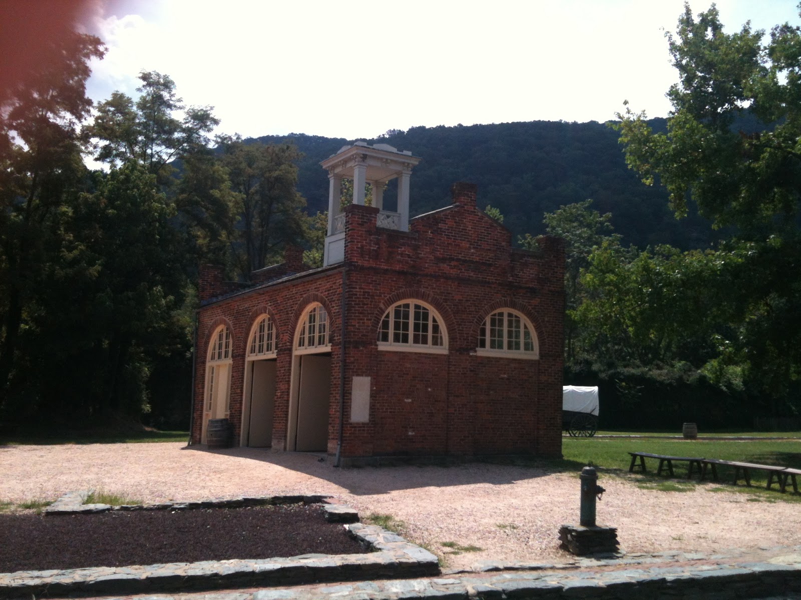
 |
| Harper's Ferry armory. |
 |
| AT sign in front of the armory. |
 |
| This way to the AT! Very cool old bridge spanning the Potomac River. Even more fun when a train crosses. |
 |
| Train tunnel bored into Maryland Heights. |
 |
| Canal path along the Potomac leading from bridge to Maryland Heights trail. |
 |
| My 'Lord of the Rings' shot. Welcome to Maryland Heights - at this point in August humidity I was starting to get winded. Thankful for the shade and a full Camel Back! |
 |
| An hour later - lunch with a view. |
 |
| Looking up stream of the Potomac River from my lunch perch. |
 |
| Some fellow hikers enjoying the view. |
Below is a map of the Maryland Heights trail as well as links to more information regarding the trail and its historical significance. Have fun and enjoy the views.
Hiking Up Ward -
Maryland Heights Trail Info
NPS -
Hiking Trail & Historical Info
 |
| Maryland Heights Trail (photo courtesy of NPS) |


No comments:
Post a Comment